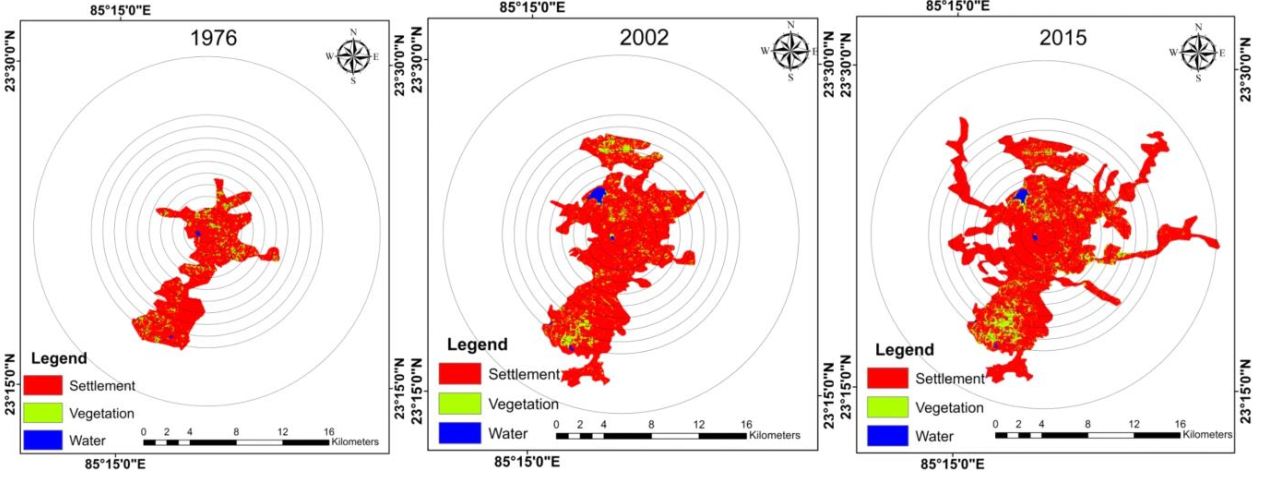
The present study analysed the urban sprawl in Ranchi city, using Landsat data from 1976, 2002 and 2015. The study revealed that the annual urban growth rate was 1.76 ha/yr over the period from 1976 to 2002 whereas the annual growth rate was 2 ha/yr over the period from 2002 to 2015. The northern side of the city has witnessed more expansion in 2002 when compared with the growth in 1976. Increase in urban density was seen at the distances of 3, 4,5,6,7 and 8km between 1976 and 2015 and the rate was higher than 25%. The driving factors of the development were infrastructure, educational and business expansion. Thus, spatial analyses of urban sprawl are a prerequisite for curbing the unplanned urban growth and ensure sustainable living.
Authors- Feroz Ahmed (Department of Remote Sensing, Birla Institute of Technology) and Laxmi Goparaju (Vindhyan Ecology and Natural History Foundation)
Access the full paper free of cost here http://www.degruyter.com/downloadpdf/j/jengeo.2016.9.issue-1-2/jengeo-2016-0002/jengeo-2016-0002.xml